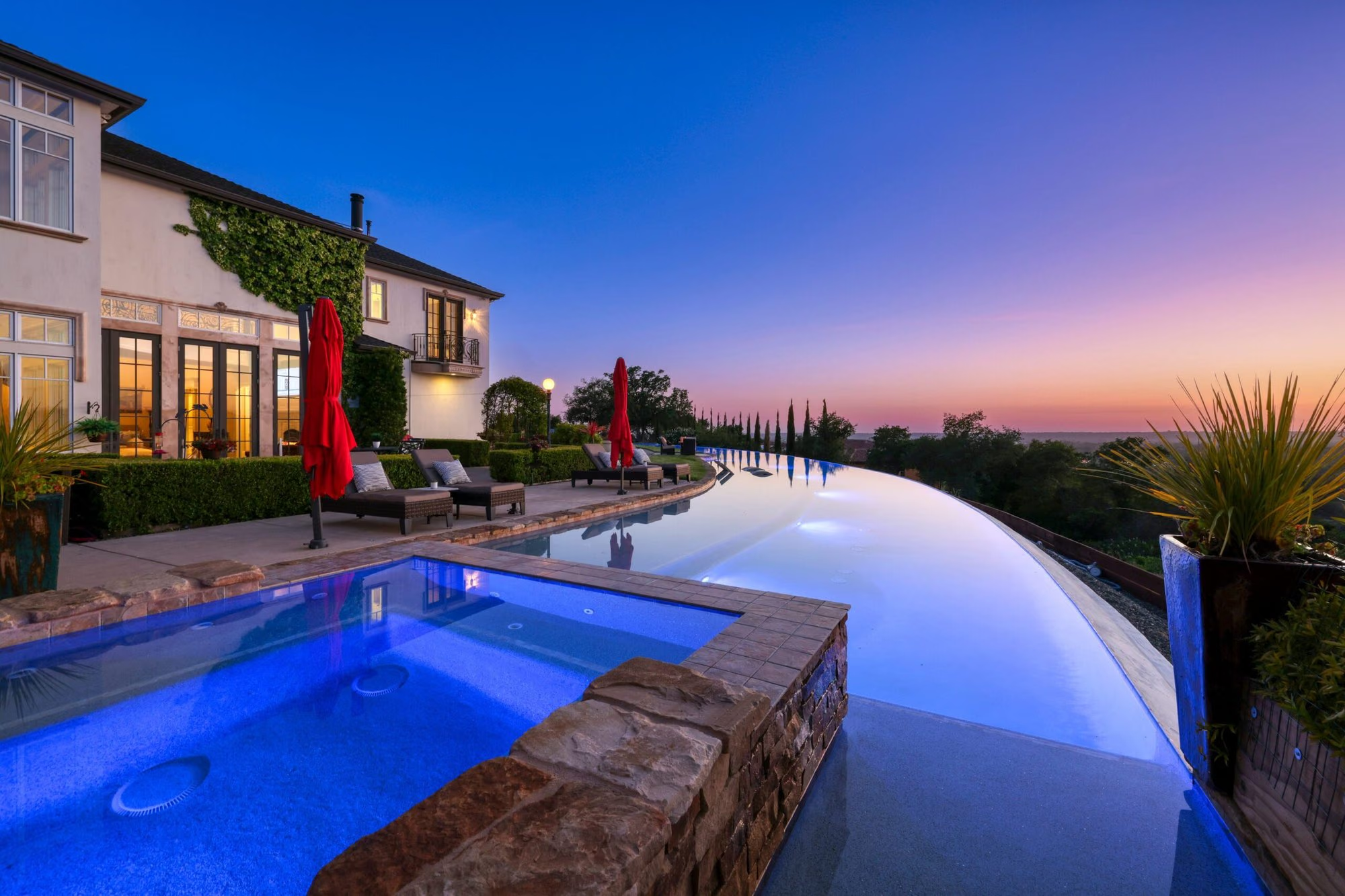
El Dorado County climbs from the Sacramento County line at Folsom Lake into the Sierra Nevada, and most of its towns sit along Highway 50 on the western slope. El Dorado Hills, Cameron Park, Shingle Springs, and Placerville, the county seat, are within commuting range of Sacramento, with Apple Hill, the El Dorado wine region, and Eldorado National Forest just beyond. South Lake Tahoe is also in the county; these pages focus on the western slope.
- Highway 50 corridor from Folsom Lake to the Sierra
- Placerville, the county seat, with a Gold Rush Main Street
- Apple Hill farms and the El Dorado AVA wine region
- Eldorado National Forest and the Desolation Wilderness
- Folsom Lake State Recreation Area at Browns Ravine
- Mostly unincorporated, served by community services districts
About El Dorado County
El Dorado County runs from the Gold Country foothills in the west to the Sierra crest and Lake Tahoe in the east. On the western slope, Highway 50 links Folsom Lake, El Dorado Hills, Cameron Park, Shingle Springs, Placerville, Camino, and Pollock Pines, and the landscape shifts along that route from oak woodland to pine forest.
The county’s name is Spanish for "the golden." Gold was discovered at Sutter’s Mill in Coloma, on the South Fork of the American River, in 1848, and the camps that followed became Placerville, Shingle Springs, and Georgetown. Placerville became the county seat in 1857. Eldorado National Forest, headquartered there, covers a large share of the county and includes the Desolation Wilderness, and the El Dorado AVA, established in 1983, spreads vineyards around Placerville, Camino, Pleasant Valley, and Fair Play.
Placerville and South Lake Tahoe are the only incorporated cities; El Dorado Hills, Cameron Park, and Shingle Springs are governed by the county and served by community services districts for parks, fire, and other local functions.
Cities and communities in El Dorado County
The western slope has four principal communities, all on Highway 50, and the choice among them usually comes down to lot size and commute length.
El Dorado Hills is the county’s largest community and its most planned, a collection of villages on both sides of Highway 50 with the El Dorado Hills Town Center, Folsom Lake frontage at Browns Ravine, and a large community services district park system. Within it, Serrano is a gated golf-course community built around Serrano Country Club.
Cameron Park sits east of El Dorado Hills at a higher elevation, with Cameron Park Lake, Cameron Park Country Club, and the Cameron Park Airpark, where streets double as aircraft taxiways.
Shingle Springs is the rural neighbor to the east, a former Gold Rush camp known for acreage, horse property, and country roads off Mother Lode Drive. Red Hawk Resort + Casino, operated by the Shingle Springs Band of Miwok Indians, sits above Highway 50 here.
Placerville is the county seat and the historic center of the western slope, with a Gold Rush Main Street, the county fairgrounds, and Marshall Hospital. Apple Hill and the wine region begin at the city’s edge.
Housing across El Dorado County
Housing in El Dorado County shifts from master-planned subdivisions near the Sacramento County line to acreage and historic homes as Highway 50 climbs. El Dorado Hills has the newest and most uniform stock, Cameron Park mixes established neighborhoods with large-lot pockets, and Shingle Springs and Placerville offer the most land and the oldest homes.
In El Dorado Hills most homes were built from the 1990s onward in villages with homeowners associations, and newer villages carry Community Facilities District (Mello-Roos) assessments; custom homes on view lots concentrate in Serrano, The Promontory, and the hills above Folsom Lake. East of Cameron Park, Shingle Springs is defined by parcels of one acre to twenty or more with barns and private wells, and Placerville has Victorian and early twentieth-century homes near Main Street, postwar hillside neighborhoods, and rural property outside the city limits.
Getting around El Dorado County
Highway 50 is the spine of the western slope, running from Sacramento through Folsom and every major El Dorado County community on its way to South Lake Tahoe. Highway 49 crosses it at Placerville, linking north to Coloma and Auburn and south to Amador County, and State Route 193 leaves Placerville for Georgetown and Cool.
Commuters drive Highway 50 west through Folsom and Rancho Cordova or ride El Dorado Transit’s weekday commuter buses, which leave park-and-ride lots in El Dorado Hills, on Bass Lake Road, on Ponderosa Road in Shingle Springs, on Ray Lawyer Drive in Placerville, and in Diamond Springs for downtown Sacramento. Winter chain controls apply on Highway 50 east of Placerville.
What to know before buying in El Dorado County
Buyers in El Dorado County should check five things early: wildfire hazard zone, water and sewer source, Mello-Roos and HOA assessments, zoning and road access, and whether the property is inside a city or in the unincorporated county.
Wildfire: CAL FIRE and the Office of the State Fire Marshal map Fire Hazard Severity Zones, and much of the county falls in moderate, high, or very high zones. The zone drives defensible space requirements, building standards, seller disclosures, and insurance availability and cost.
Water and sewer: The El Dorado Irrigation District supplies water, and in many areas sewer, along the Highway 50 corridor. Outside its service areas, homes rely on private wells and septic systems, which should be tested and inspected during escrow.
Assessments: Newer El Dorado Hills villages carry Community Facilities District bonds, and some carry a second services district for landscaping and lighting with no fixed end date. Older neighborhoods often have neither an HOA nor Mello-Roos.
Zoning and access: Acreage may be zoned residential-agricultural or agricultural, which governs animals, outbuildings, and second units, and many rural homes sit on private roads under shared maintenance agreements.
Buying or selling in El Dorado County
Nick Sadek Sotheby’s International Realty works with buyers and sellers across El Dorado County’s western slope from its four offices in Roseville, Sacramento, Woodland, and Nevada City. Local agents know the distinctions between El Dorado Hills villages, the covenants in Cameron Park, and the well, septic, and road questions that come with acreage in Shingle Springs and around Placerville.
Listings are presented through the Sotheby’s International Realty global network. Buyers can search current listings, owners can request a home value estimate, and anyone can meet the agents or contact an office. Neighboring markets are covered on the Sacramento County and Placer County pages.
El Dorado County homes for sale
Live El Dorado County listings from MetroList will display here once the property search is connected.
Browse El Dorado County listingsPrefer to talk it through? Call 916.784.7444 and an agent will send you a curated list.
Questions buyers ask about El Dorado County
Which El Dorado County communities are closest to Sacramento?
El Dorado Hills sits at the county line next to Folsom and is the first El Dorado County community on Highway 50 heading east. Cameron Park and Shingle Springs follow in that order, and Placerville is farther up the hill where Highway 50 meets Highway 49. The commute lengthens in steps along the same highway.
Is El Dorado County in a wildfire zone?
Large parts of the county are mapped by CAL FIRE as moderate, high, or very high Fire Hazard Severity Zones, including foothill neighborhoods along Highway 50. The designation affects defensible space rules, building codes, disclosures, and insurance. Check the zone for a specific address on the state’s online map before making an offer.
Do homes in El Dorado County have well and septic systems?
It depends on location. The El Dorado Irrigation District serves water and sewer to most of El Dorado Hills, Cameron Park, and the Highway 50 corridor through Placerville. Rural parcels in Shingle Springs, outlying Cameron Park, and the county around Placerville often rely on private wells and septic systems, which should be tested during escrow.
What is Mello-Roos and where does it apply in El Dorado County?
Mello-Roos is a Community Facilities District assessment on the property tax bill that repays bonds for infrastructure or funds ongoing services. In El Dorado County it is most common in newer El Dorado Hills villages such as Serrano, Blackstone, The Promontory, Bass Lake Hills, and Carson Creek. Ask for the current amount and maturity date.
Does El Dorado County include Lake Tahoe?
Yes. South Lake Tahoe, an incorporated city, and the California side of the southern Lake Tahoe Basin are in El Dorado County, reached by Highway 50 over Echo Summit. These community pages focus on the western slope between Folsom Lake and Placerville, where most of the county’s population lives.