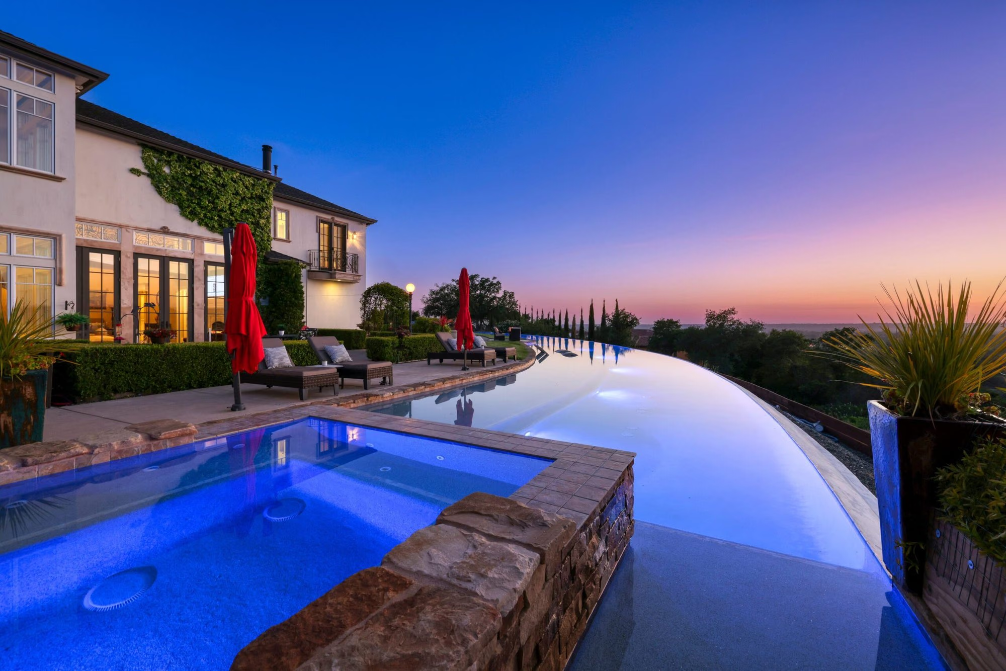
Placerville is the county seat of El Dorado County and an incorporated city at the junction of Highway 50 and Highway 49 in the Sierra foothills. Its Main Street dates to the Gold Rush, and Apple Hill’s farms, the El Dorado wine region, and Eldorado National Forest begin at the city’s edge. Housing spans Victorian-era homes in historic districts, postwar hillside neighborhoods, and rural acreage outside the city limits.
- El Dorado County seat at Highway 50 and Highway 49
- Historic Main Street with the 1865 Bell Tower
- Four residential historic districts with design review
- Apple Hill farms and El Dorado AVA wineries nearby
- Gold Bug Park and Mine, a city park with mine tours
- El Dorado High School, El Dorado Union High School District
Living in Placerville
Placerville is a small city of historic streets and four distinct seasons, positioned above the valley fog and below the Sierra snow line. It is the civic center of El Dorado County, with the county offices, the El Dorado County Fairgrounds, Marshall Hospital, and the headquarters of Eldorado National Forest.
The city grew from a mining camp founded after gold was found at nearby Coloma in 1848, was incorporated in 1854, and became the county seat in 1857. The Bell Tower, installed in 1865 as a monument to the city’s volunteer firemen, still anchors Main Street.
Neighborhoods and housing in Placerville
Placerville housing falls into three groups: historic homes near Main Street, postwar and later subdivisions on the hillsides and along the highways, and acreage in the unincorporated county around the city.
The historic core includes Victorian, Craftsman, and early twentieth-century homes on the streets climbing from Main Street, and in 1981 the City Council designated four residential historic districts: Spring Street and Coloma Street, Bedford Avenue and Clay Street, Cedar Ravine, and Sacramento Street and Chamberlain Street.
Beyond the core, neighborhoods from the 1950s through the 1990s spread along Broadway, Cedar Ravine Road, and the hills south of Highway 50, on sloped, wooded lots. Outside the city limits, in Diamond Springs, Camino, and the Newtown Road area, properties move to one acre and larger. Shingle Springs to the west continues the acreage pattern.
Historic Main Street and Gold Rush history in Placerville
Historic Main Street is a working downtown of nineteenth-century brick and stone buildings holding restaurants, antique shops, galleries, wine tasting rooms, and the Bell Tower plaza where community events gather.
The town was called Dry Diggins for its mining method and then Hangtown from 1849, before incorporating as Placerville, named for the placer gold in its creeks, in 1854. Gold Bug Park and Mine, about a mile north of Main Street, is a city park of more than sixty acres with a hard-rock gold mine open for self-guided tours and hiking trails.
Apple Hill, wineries, and the outdoors
Apple Hill begins at Placerville’s eastern edge in Camino, where the Apple Hill Growers Association’s member ranches open for apples, pears, Christmas trees, and tasting rooms each fall. The El Dorado AVA, established in 1983, surrounds the city with vineyards between roughly six hundred and thirty-five hundred feet of elevation.
The El Dorado Trail runs through Placerville on the old rail corridor, with paved segments from the town of El Dorado through the city to Camino, open to walkers, cyclists, and equestrians. The El Dorado County Fair has been held at the Placerville fairgrounds since 1859 and runs each June. Eldorado National Forest lies east on Highway 50, and the South Fork of the American River at Coloma, north on Highway 49, is the region’s whitewater rafting center. Folsom Lake and El Dorado Hills are west on Highway 50.
Schools and public services
Placerville is served by the Placerville Union School District for most of the city and the Mother Lode Union School District for a small portion, and by the El Dorado Union High School District for high school. El Dorado High School, established in 1928, is the district’s Placerville campus.
Marshall Hospital, the county’s acute-care hospital, is in Placerville, operated by the nonprofit Marshall health system. Inside the city limits the city handles planning and streets and the El Dorado Irrigation District supplies water; outside, El Dorado County governs land use and many properties rely on wells and septic systems.
Getting around and commuting from Placerville
Placerville sits where Highway 50 crosses Highway 49, with State Route 193 leaving the north side of the city for Georgetown and Cool. Highway 49 runs north to Coloma and Auburn and south toward Amador County.
The Sacramento commute from Placerville is long by regional standards and runs through Shingle Springs, Cameron Park, El Dorado Hills, and Folsom. El Dorado Transit’s weekday commuter buses leave the Ray Lawyer Drive Park and Ride and the Central Park and Ride in Diamond Springs for downtown Sacramento. Winter storms bring chain controls on Highway 50 east of the city.
What to know before buying in Placerville
Buyers in Placerville should check whether a property is inside the city limits or in the unincorporated county, whether it sits in one of the four residential historic districts, its Fire Hazard Severity Zone, and its water, sewer, and access.
Historic districts: A home within the Spring Street-Coloma Street, Bedford Avenue-Clay Street, Cedar Ravine, or Sacramento Street-Chamberlain Street districts, or any structure designated historic, may require Historic District Review for exterior changes through the Planning Division.
Wildfire: Placerville is forested foothill terrain, and both the city and the surrounding county fall within mapped Fire Hazard Severity Zones, with many areas rated high or very high.
Hillside and rural lots: Steep lots can involve drainage, retaining walls, and limited parking, and older homes may have original foundations and plumbing. Outside the city, wells, septic systems, propane, and private roads are common.
Buying or selling in Placerville
Nick Sadek Sotheby’s International Realty works with buyers and sellers in Placerville through local agents who know the historic districts, the hillside neighborhoods, and the acreage around the city. The brokerage operates from four offices in Roseville, Sacramento, Woodland, and Nevada City, and its listings are marketed through the Sotheby’s International Realty global network.
Buyers can search current listings in Placerville and neighboring Cameron Park, and owners can request a home value estimate. To talk through a neighborhood or a historic property, meet the agents or contact an office. The wider market is on the El Dorado County page.
Placerville homes for sale
Live Placerville listings from MetroList will display here once the property search is connected.
Browse Placerville listingsPrefer to talk it through? Call 916.784.7444 and an agent will send you a curated list.
Questions buyers ask about Placerville
What is Placerville known for?
Placerville is known as the Gold Rush town once called Hangtown, for its Historic Main Street and Bell Tower, and for being the El Dorado County seat at the junction of Highway 50 and Highway 49. Apple Hill in neighboring Camino, the El Dorado wine region, and Gold Bug Park and Mine are the local landmarks.
Are there historic district rules for homes in Placerville?
Yes. The city designated four residential historic districts in 1981: Spring Street-Coloma Street, Bedford Avenue-Clay Street, Cedar Ravine, and Sacramento Street-Chamberlain Street. Exterior remodeling of a home in those districts, or of any designated historic structure, may require Historic District Review through the Planning Division.
What school districts serve Placerville?
Most of the city is in the Placerville Union School District, with a small portion in the Mother Lode Union School District, for elementary and middle grades. The El Dorado Union High School District serves high school, with El Dorado High School, established in 1928, in Placerville.
Is Placerville in a wildfire zone?
Yes. Placerville and the surrounding county are forested foothill terrain mapped by CAL FIRE in Fire Hazard Severity Zones, with many areas rated high or very high. The designation affects defensible space requirements, building standards, seller disclosures, and insurance cost and availability.
Does Placerville get snow?
Occasionally. Placerville sits above the valley fog and below the main Sierra snow line, so winter storms sometimes leave snow on city streets that usually melts within a day or two. Snow is more frequent in Camino and Pollock Pines just east, and Highway 50 toward Lake Tahoe has chain controls during storms.
Ask a Placerville agent
Tell us what you are looking for in Placerville, or what you are thinking of selling, and a local agent will follow up.