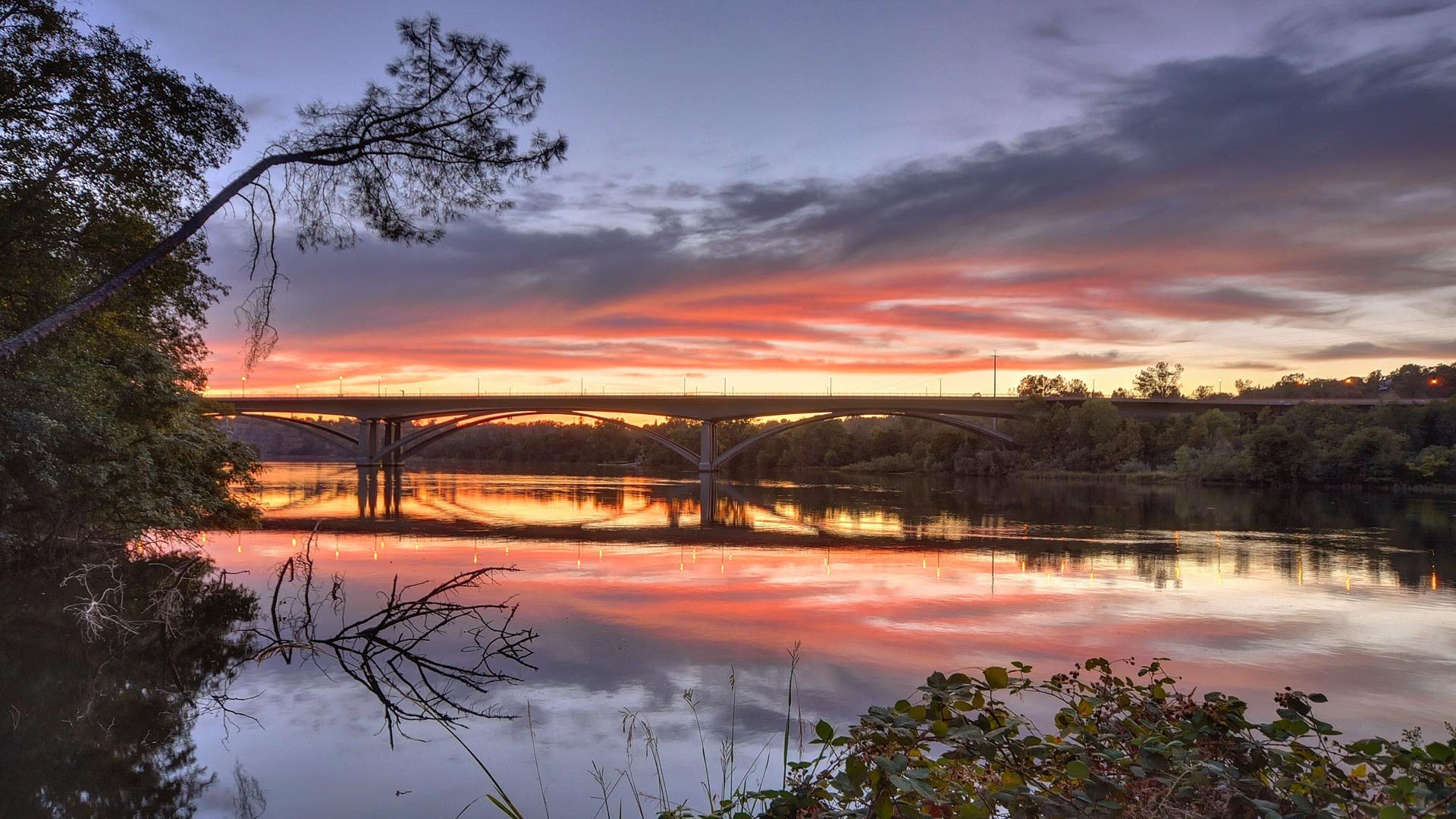
Orangevale is an unincorporated community in northeastern Sacramento County, between Fair Oaks and Citrus Heights to the west and Folsom to the east, with Lake Natoma and the American River along its southern edge. It began in the 1890s as the Orange Vale citrus colony and remains a community of single-family homes on lots that are often larger than its neighbors'. The 95662 ZIP code covers the community.
- Larger lots and semi-rural parcels at the foothill edge
- Lake Natoma and the American River Parkway along the southern edge
- Folsom Lake State Recreation Area a short drive east
- Orangevale Community Park, 76 acres with disc golf
- Founded in the 1890s as the Orange Vale citrus colony
- San Juan Unified School District, including Casa Roble Fundamental High School
Living in Orangevale
Orangevale is a low-density community on gently rolling ground at the base of the Sierra foothills, with mature oaks, a mix of suburban tracts and large parcels, and quick access to Folsom Lake and Lake Natoma. It was carved from the 1844 Rancho San Juan grant and marketed in the 1890s as the Orange Vale colony for citrus and olive groves, and remnants of that pattern survive in deep lots along its older roads.
The community is governed by Sacramento County rather than a city, with the Orangevale Recreation and Park District operating its parks and the Sacramento Metropolitan Fire District and county Sheriff’s Office providing services. Greenback Lane, Madison Avenue, Hazel Avenue, Main Avenue, and Oak Avenue are the main roads. The annual Pow Wow Days, a three-day fair with a parade and carnival organized by the Orangevale Chamber of Commerce, has been held at Orangevale Community Park for more than fifty years, typically around the start of June.
Neighborhoods and housing in Orangevale
Orangevale’s housing is almost entirely single-family homes, with a wider range of lot sizes than most of the county. Standard suburban tracts from the 1960s through the 1980s sit along Greenback Lane and Madison Avenue, while the streets between them and toward the lake hold half-acre, one-acre, and larger parcels with ranch and custom homes and room for outbuildings and animals. The southern part toward Lake Natoma and Folsom has some of the largest parcels, and the oak-studded terrain gives many lots a semi-rural feel minutes from shopping. There is no master-planned development on the scale of neighboring Folsom.
Townhomes and condominiums are limited and concentrated near Greenback Lane and Madison Avenue. Horse keeping is permitted on some parcels under county agricultural-residential zoning, so buyers interested in animals should confirm zoning for a specific lot.
Parks, trails, and recreation in Orangevale
The Orangevale Recreation and Park District runs a network of parks across the community. Orangevale Community Park is the largest at 76 acres, with three recreation areas and the Shady Oaks Disc Golf Course. The Orangevale Community Center Park holds the community center, a swimming pool, and an activity building. Almond Park has tennis courts, playgrounds, sand volleyball courts, and a paved loop; Pecan Park adds a dog park, tennis and basketball courts; and the Sundance Nature Area preserves a wooded natural area with walking paths.
Lake Natoma and the American River Parkway lie along Orangevale’s southern edge, with trail access toward Folsom and down the river to Fair Oaks and Sacramento. Folsom Lake State Recreation Area is a short drive east for boating, swimming, fishing, and roughly 95 miles of trails, and Lake Natoma, formed by Nimbus Dam, is used for rowing, paddling, and flat-water recreation.
Dining, shopping, and daily life in Orangevale
Orangevale’s commerce is concentrated along Greenback Lane and Madison Avenue in neighborhood shopping centers with groceries, restaurants, and services, with Main Avenue and Hazel Avenue adding smaller clusters. There is no historic downtown; residents use Fair Oaks Village to the west, Historic Folsom’s Sutter Street to the east, and the Palladio and Folsom Premium Outlets for larger shopping.
Mercy San Juan Medical Center in Carmichael and the hospitals in Folsom and Roseville are the nearest medical centers.
Schools and public services in Orangevale
Orangevale is served by the San Juan Unified School District, with Casa Roble Fundamental High School inside the community along with several elementary and middle schools. The district offers open enrollment options, and attendance areas are set by address, so confirm assignments for a specific property.
Sacramento County provides planning, permits, and roads. The Orangevale Recreation and Park District operates the parks and community center. Water service comes from local water districts depending on location, and some parcels are on private wells or septic systems.
Getting around and commuting from Orangevale
Orangevale sits between Interstate 80 and Highway 50 without either freeway passing through it. Greenback Lane leads west to Interstate 80 toward Roseville and downtown, Hazel Avenue leads south across the river to Highway 50 toward Folsom and downtown, and Madison Avenue is the main east-west connector.
Regional Transit buses serve Greenback Lane and Madison Avenue, the nearest light rail is the Gold Line at the Historic Folsom and Hazel stations, and cyclists reach the parkway and Lake Natoma trails from the southern edge of the community.
What to know before buying in Orangevale
Utilities, zoning, and lot conditions vary more in Orangevale than in most of the county. Many parcels are on public water and sewer, but older and larger lots may be on septic systems or private wells, so confirm what serves a specific property and request inspection records. Check the county zoning if you plan to keep horses or build a second unit or workshop.
Homes range from 1960s ranches to new customs, so inspection needs vary. Properties near Lake Natoma or the parkway should be checked for FEMA flood zone status, and the eastern edge near Folsom Lake should be checked against state fire hazard severity maps. Homeowner associations are rare outside the few townhome complexes. Neighbors are Fair Oaks to the west, Folsom to the east, Carmichael further west, and Granite Bay across the county line to the north.
Buying or selling in Orangevale
Nick Sadek Sotheby’s International Realty serves Orangevale from its Roseville office on Sierra College Boulevard and its Sacramento office on Fair Oaks Boulevard, with additional offices in Woodland and Nevada City. Agents who work the lake-side communities can compare an acre parcel near Lake Natoma with a Greenback Lane tract home, and sellers gain exposure through the Sotheby’s International Realty global network.
Search current listings in Orangevale, find out what your home is worth, meet our agents, or contact us. See the Sacramento County hub for the surrounding communities.
Orangevale homes for sale
Live Orangevale listings from MetroList will display here once the property search is connected.
Browse Orangevale listingsPrefer to talk it through? Call 916.784.7444 and an agent will send you a curated list.
Questions buyers ask about Orangevale
What is Orangevale known for?
Orangevale is known for larger lots and a semi-rural character at the foothill edge of Sacramento County, proximity to Lake Natoma and Folsom Lake, and its origins as the 1890s Orange Vale citrus colony. Orangevale Community Park, the Pow Wow Days fair, and mature oak-studded parcels are its signatures.
Can you have horses in Orangevale?
On some parcels, yes. Parts of Orangevale carry Sacramento County agricultural-residential zoning that permits horses and other animals on lots that meet minimum size requirements, which is one reason the community attracts buyers who want acreage close to town. Zoning varies lot by lot, so confirm the designation for any specific property with the county.
How do you commute from Orangevale to downtown Sacramento?
Drivers take Greenback Lane west to Interstate 80, or Hazel Avenue south across the American River to Highway 50, then west to downtown. Neither freeway passes through Orangevale, so most trips start on surface streets. The Gold Line light rail is reachable at the Hazel station or Historic Folsom station for a car-free trip to downtown.
What school district serves Orangevale?
The San Juan Unified School District serves Orangevale. Casa Roble Fundamental High School is inside the community, along with several elementary and middle schools, and the district offers open enrollment options. Attendance areas are set by address, so confirm assignments for a specific home with the district.
Ask a Orangevale agent
Tell us what you are looking for in Orangevale, or what you are thinking of selling, and a local agent will follow up.