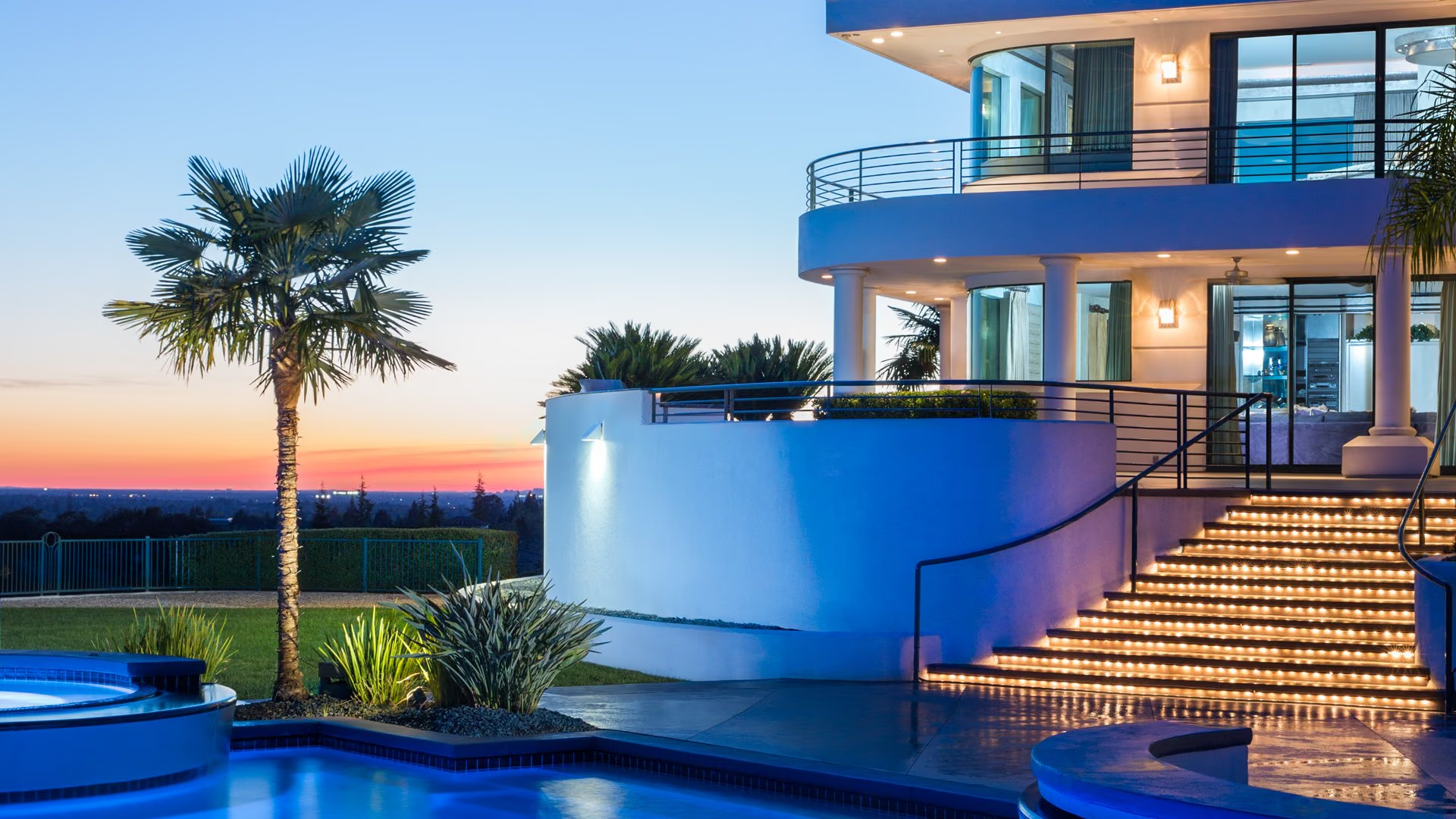
Auburn is the county seat of Placer County, a Gold Rush town in the Sierra Nevada foothills at the junction of Interstate 80 and State Route 49. It sits above the confluence of the North and Middle Forks of the American River, with the Auburn State Recreation Area at its doorstep and an Old Town on the National Register of Historic Places. Housing ranges from Victorian homes near the courthouse to foothill parcels on acreage.
- Placer County seat since 1851; Old Town on the National Register
- Auburn State Recreation Area and the American River confluence
- Finish line of the Western States Endurance Run and Tevis Cup
- Eastern terminus of the Amtrak Capitol Corridor
- Interstate 80 and State Route 49 meet in the city
- Hidden Falls Regional Park northwest of town
Living in Auburn
Auburn sits at an elevation of about 1,200 feet on the rim of the American River canyons, roughly 800 feet above the point where the North and Middle Forks meet. Gold was found in Auburn Ravine in May 1848, the town was named in 1849 by miners from Auburn, New York, and it became the Placer County seat in 1851. The city incorporated in 1888, and the whole of Old Town is registered as a California Historical Landmark and listed on the National Register of Historic Places.
Auburn also calls itself the Endurance Capital of the World, and earns it. The Western States Endurance Run and the Tevis Cup trail ride both finish here after 100 miles over the Sierra, and the trails that make those events possible start at the edge of town.
Daily life is organized around two centers: Old Town, with its 1850s commercial buildings on Commercial Street and the 1897 Placer County Courthouse on Maple Street, and the downtown blocks nearby.
Neighborhoods and housing in Auburn
Auburn’s housing is older and more varied than the valley cities'. The blocks around Old Town and the courthouse hold Victorian and early twentieth-century homes on small lots, some restored and some waiting. Mid-century neighborhoods ring the historic core on both sides of Interstate 80, with ranch homes on quarter-acre to half-acre lots and mature trees.
Toward the edges of the city and beyond its limits in unincorporated North Auburn and the surrounding foothills, lots grow to an acre and more, and custom homes sit on wooded parcels with views across the canyons or toward the Sierra. Ranch properties and small vineyards and orchards continue the agricultural tradition that once made Auburn a major plum producer. Meadow Vista, higher up Interstate 80, and Newcastle, just below, extend the same pattern in either direction.
New construction is limited to small subdivisions and custom homes. HOAs are uncommon outside a few planned neighborhoods.
Parks, trails, and recreation in Auburn
The Auburn State Recreation Area is the reason many people move here. It covers more than 42,000 acres along about 40 miles of the North and Middle Forks of the American River, with over 100 miles of trail. The Western States Trail passes through on its way from Lake Tahoe to Auburn, the Confluence Trail and Quarry Trail start near the river crossing below town, and the Lake Clementine Trail leads to a narrow reservoir behind North Fork Dam. Whitewater rafting on Class II through IV runs, swimming holes, gold panning, mountain biking, and horseback riding are all within the recreation area, and the Foresthill Bridge, the highest bridge in California, spans the canyon above it.
Hidden Falls Regional Park, a Placer County park of about 1,200 acres outside the city with access from Mears Place, has a trail network for hikers, riders, and cyclists and is in the middle of a multi-year expansion.
Dining, shopping, and daily life in Auburn
Old Town Auburn is a compact district of Gold Rush-era buildings on Commercial, Court, Washington, Spring, and Sacramento Streets, with restaurants, bars, antique shops, galleries, and the Auburn Joss House alongside the courthouse. The downtown blocks nearby carry everyday retail, cafes, and professional offices, and the city’s event calendar fills both areas with festivals, markets, and the endurance-event finishes that draw crowds each summer.
Grocery stores, hardware, and services line the Interstate 80 corridor through the city.
Schools and public services in Auburn
Auburn is served by the Auburn Union School District for transitional kindergarten through eighth grade, with Auburn Elementary, E.V. Cain, and Skyridge Elementary, and by the Placer Union High School District, whose Auburn campus is Placer High School, one of the oldest high schools in California. Some outlying addresses fall within neighboring elementary districts, so confirm attendance areas by address.
As county seat, Auburn houses Placer County’s administrative offices and courts. Placer County Water Agency, headquartered on Ferguson Road, provides treated water and raw canal water for irrigation. Amtrak and Placer County Transit connect Auburn to the rest of the region.
Getting around and commuting from Auburn
Interstate 80 passes through the center of Auburn, carrying traffic southwest to Loomis, Rocklin, Roseville, and Sacramento and northeast toward Colfax, Truckee, and Reno. State Route 49 crosses here, running north to Grass Valley and Nevada City and south across the American River to Cool and El Dorado County. State Route 193 connects Lincoln to Newcastle just below the city.
Auburn is the eastern terminus of Amtrak’s Capitol Corridor, with trains a few times a day to Sacramento and the Bay Area. Auburn Municipal Airport, north of the city, serves general aviation.
What to know before buying in Auburn
Fire is the first question. Much of Auburn and nearly all of the surrounding unincorporated area falls within mapped fire hazard severity zones, and parcels in very high zones carry a 100-foot defensible space requirement, wildland-urban interface building codes for new work, and mandatory disclosure at sale. Check the designation for any parcel and ask about insurance availability early.
Outside the city’s sewer and water systems, wells and septic are standard, and PCWA canal water for irrigation is an asset worth confirming. Steep canyon-edge lots can involve grading, drainage, and access questions. Homes in Old Town and the historic districts may be subject to design review for exterior changes; ask the city about historic preservation requirements before planning a remodel.
Buying or selling in Auburn
Nick Sadek Sotheby’s International Realty serves Auburn from its Roseville office on Sierra College Boulevard and its Nevada City office on Broad Street, with Sacramento and Woodland offices completing the network. Its agents are familiar with foothill transactions: fire zones, wells and septic, canal water, canyon lots, and historic homes. Sellers receive local representation together with the Sotheby’s International Realty global network.
Begin with a search of current Auburn listings, a home value estimate, a visit with our agents, or a call to one of our offices. Nearby communities include Meadow Vista, Newcastle, and Loomis, and the full area is covered on the Placer County page.
Auburn homes for sale
Live Auburn listings from MetroList will display here once the property search is connected.
Browse Auburn listingsPrefer to talk it through? Call 916.784.7444 and an agent will send you a curated list.
Questions buyers ask about Auburn
What school districts serve Auburn?
Auburn is served by the Auburn Union School District for transitional kindergarten through eighth grade, with Auburn Elementary, E.V. Cain, and Skyridge Elementary, and by the Placer Union High School District, whose Auburn campus is Placer High School. Addresses on the edges of the city may fall within neighboring elementary districts, so verify by address.
Is Auburn in a wildfire zone?
Much of it is. Auburn and the surrounding foothills fall within mapped fire hazard severity zones, and parcels in very high zones require 100 feet of defensible space, follow wildland-urban interface building codes for new construction, and must be disclosed at sale. Check Placer County’s map viewer for any parcel and ask about insurance availability early in the process.
How far is Auburn from Sacramento?
Auburn is on Interstate 80 northeast of Sacramento, and the drive follows the freeway southwest through Loomis, Rocklin, and Roseville directly into the city. Auburn is also the eastern terminus of Amtrak’s Capitol Corridor, with a few trains a day to Sacramento Valley Station and on to the Bay Area.
What is Auburn known for?
Auburn is known as a Gold Rush town and the Placer County seat, with an Old Town on the National Register of Historic Places and the 1897 courthouse above it. It is also known as the Endurance Capital of the World, the finish line of the Western States Endurance Run and the Tevis Cup, and the gateway to the Auburn State Recreation Area’s river canyons.
Ask a Auburn agent
Tell us what you are looking for in Auburn, or what you are thinking of selling, and a local agent will follow up.